This glossary of AIS terms has been compiled for your reference, in alphabetical order. Is something missing? Please contact us!
| AIS ATONS DHS DSC ESA ESP FCC |
GMDSS GPS IEC IMO ITU LNA MDA |
MMSI MURS NOISESION RTCM SBIR SOLAS STM |
UAIS VTC |
AIS
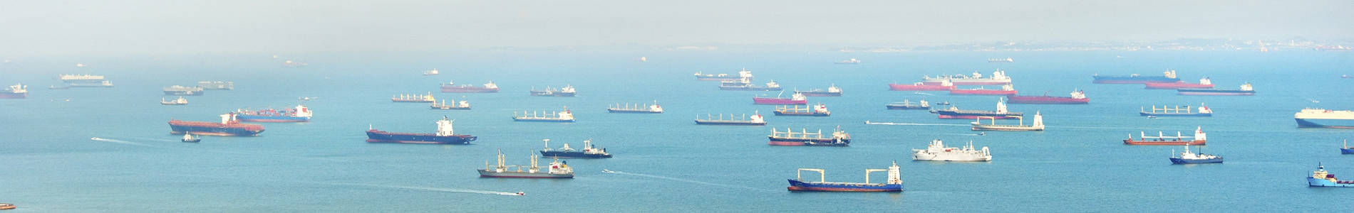
An Automatic Identification System (AIS) is used for identifying and monitoring maritime traffic. AIS sends and receives vessel identification information which can be displayed on a laptop computer or chart plotter. Information such as vessel name, radio call sign, navigational status (eg. at anchor, under way using engine), speed, heading, type of ship/cargo, destination, and estimated time of arrival are all examples of information that can be displayed.
AIS Broadcasts:
|
Some applications for AIS include:
|
Further details on AIS can be found on the USCG website.
ATONs
Aids To Navigation (ATONs) are man made objects created to assist mariners in determining the safest course to travel. These objects include buoys, day markers, and lights which employ the use of color, shape and sound to assist in navigation.
Further details on ATONs, and AIS messages specific to ATONs, can be found on the USCG website.
DHS
Department of Homeland Security
Excerpt from http://www.dhs.gov:
The Department of Homeland Security has a vital mission: to secure the nation from the many threats we face. This requires the dedication of more than 240,000 employees in jobs that range from aviation and border security to emergency response, from cybersecurity analyst to chemical facility inspector. Our duties are wide-ranging, and our goal is clear – keeping America safe.
For more information about the DHS click here.
DSC
Digital Selective Calling
Excerpt from http://www.navcen.uscg.gov/?pageName=AboutDSC
Digital Selective Calling (DSC), allows mariners to instantly send an automatically formatted distress alert to the Coast Guard or other rescue authority anywhere in the world. Digital selective calling also allows mariners to initiate or receive distress, urgency, safety and routine radiotelephone calls to or from any similarly equipped vessel or shore station, without requiring either party to be near a radio loudspeaker. DSC acts like the dial and bell of a telephone, allowing you to “direct dial” and “ring” other radios, or allow others to “ring” you, without having to listen to a speaker. New VHF and HF radiotelephones have DSC capability.
For more information about DSC click here.
ESA
Enhanced Signal Analysis
See ESP
ESP
Enhanced Signal Analysis Package
FCC
Federal Communications Commission
Excerpt from http://www.fcc.gov/about/overview
The Federal Communications Commission regulates interstate and international communications by radio, television, wire, satellite, and cable in all 50 states, the District of Columbia and U.S. territories. An independent U.S. government agency overseen by Congress, the Commission is the federal agency responsible for implementing and enforcing America’s communications law and regulations.
For more information about the FCC click here.
GMDSS
Global Maritime Distress & Safety System (GMDSS) was developed by the United Nations agency, the International Maritime Organization (IMO), as the internationally accepted system of coordinated radio communications (ship-to-ship and ship-to-shore) using satellite and terrestrial networks for commercial vessels.
The GMDSS consists of several systems, some of which are new, but many of which have been in operation for many years. The GMDSS radio carriage requirements depend upon the ship’s area of operation, rather than its tonnage. The system also provides redundant means of distress alerting, and emergency sources of power. Recreational vessels are not required to carry GMDSS equipment; however it is strongly encouraged for all vessels on international voyages or traveling greater than 25 nm offshore because of the very efficient communications and rapid distress response. All vessels near shore and on the high seas are strongly encouraged to apply for an MMSI number to allow the use of Digital Selective Calling (DSC) in the case of an emergency.
Automatic Identification System (AIS) has become an important element of the GMDSS monitoring system because of its ability to provide immediate and accurate contact between vessels. To help with the coordination of vessel identity AIS users use the same MMSI numbers assigned to the vessel for GMDSS purposes. The system is backwards compatible with DSC, allowing shore-based GMDSS systems to affordably identify and track AIS-equipped vessels, and is intended to eventually replace the existing DSC-based transponder systems.
GPS
The Global Positioning System (GPS) was designed as a dual-use system with the primary purpose of enhancing the effectiveness of U.S. and allied military forces. GPS is rapidly becoming an integral component of the emerging Global Information Infrastructure, with applhttp://www.uscgboating.org/safety/metlife/aton.htmications ranging from mapping and surveying to international air traffic management and global change research.
The basic GPS is defined as the constellation of satellites, the navigation payloads which produce the GPS signals, ground stations, data links, and associated command and control facilities which are operated and maintained by the Department of Defense.GPS permits land, sea, and airborne users to determine their three dimensional position, velocity, and time, 24 hours a day in all weather, anywhere in the world.
Further details on GPS can be found on the USCG website.
IEC
International Electrotechnical Commission
Excerpt from http://www.iec.ch/
The IEC is the world’s leading organization that prepares and publishes International Standards for all electrical, electronic and related technologies — collectively known as “electrotechnology”. IEC Standards cover a vast range of technologies from power generation, transmission and distribution to home appliances and office equipment, semiconductors, fibre optics, batteries, nanotechnologies, solar energy and marine energy converters, to mention just a few. Wherever you find electricity and electronics, you find the IEC supporting safety and performance, the environment, electrical energy efficiency and renewable energies. The IEC also manages conformity assessment schemes that certify that equipment, systems or components conform to its International Standards.
For more information about IEC click here.
IMO
International Maritime Organization
Excerpt from http://www.imo.org
A specialized agency of the United Nations with 167 Member States and three Associate Members, IMO is based in the United Kingdom with around 300 international staff.
IMO’s specialized committees and sub-committees are the focus for the technical work to update existing legislation or develop and adopt new regulations, with meetings attended by maritime experts from Member Governments, together with those from interested intergovernmental and non-governmental organizations.
The result is a comprehensive body of international conventions, supported by hundreds of recommendations governing every facet of shipping. There are, firstly, measures aimed at the prevention of accidents, including standards for ship design, construction, equipment, operation and manning – key treaties include SOLAS, the MARPOL convention for the prevention of pollution by ships and the STCW convention on standards of training for seafarers.
For more information about IMO click here.
ITU
International Telecommunications Union
Excerpt from http://www.itu.int
The International Telecommunication Union (ITU) is the United Nations specialized agency for information and communication technologies – ICTs.
For more information about ITU click here.
LNA
Low Noise Amplifier
MDA
Maritime Domain Awareness (MDA) has been defined as the effective knowledge of all activities associated with the global maritime environment that could impact the security, safety, economy, or environment of the United States.
For more information about MDA click here.
MMSI
All vessels operating on the high seas require a Maritime Mobile Service Identity (MMSI) number to participate in the Global Maritime Distress & Safety System (GMDSS). In addition to GMDSS participation the MMSI number also serves as a unique identifier of the vessel for all communications. As the international governing body for telecommunications the International Telecommunications Union (ITU) has set the international conventions for the use of MMSI numbers. MMSI number is a 9-digit code issued by the host country agency for use in VHF marine radio equipment, AIS transponders, EPIRB’s, and all INMARSAT satellite terminals. By international agreement, the ITU sets the rules that determine how MMSI’s are assigned and used. In the United States the Federal Communications Commission (FCC) and in Canada Industry Canada (IC) are responsible for actually assigning MMSI’s to commercial and recreational vessels.
Further detail on the format for US MMSI numbers can be found on the USCG website.
MURS
The Multi-Use Radio Service (MURS) is a low power, short range VHF Citizens Band service in the 150 MHz band reserved world-wide for two-way communications, which allow for transmission of data such as terrestrial and marine movements.
NOISESION
An demodulator technology created exclusively by Shine Micro (patent pending), which demodulates AIS packets both forward and backward for superior reception of noisy, weak signals.
RTCM
Radio Technical Commission for Maritime Services
Excerpt from https://www.rtcm.org
The Radio Technical Commission for Maritime Services (RTCM) is an international non-profit scientific, professional and educational organization. RTCM members are organizations (not individuals) that are both non-government and government. Although started in 1947 as a U.S. government advisory committee, RTCM is now an independent organization supported by its members from all over the world.
For more information about RTCM click here.
SBIR
Small Business Innovation Research
Excerpt from https://www.sbir.gov/about/about-sbir#sbir-program
The Small Business Innovation Research (SBIR) program is a highly competitive program that encourages domestic small businesses to engage in Federal Research/Research and Development (R/R&D) that has the potential for commercialization. Through a competitive awards-based program, SBIR enables small businesses to explore their technological potential and provides the incentive to profit from its commercialization. By including qualified small businesses in the nation’s R&D arena, high-tech innovation is stimulated and the United States gains entrepreneurial spirit as it meets its specific research and development needs.
For more information about SBIR click here.
SOLAS
Safety of Life at Sea
STM
Short Text Messaging
UAIS
Universal Automatic Identification System
See AIS
VTC
Vessel Traffic Control